Tuesday, March 28, 2017

Oregon coast - Ophir Beach to Cape Blanco


Battle Rock wayside, Port Orford, OR


July 8, 2015. We started with a morning walk in Gold Beach then packed up and continued our road trip up U.S. Highway 101.

Ophir Beach

We made a number of small stops, including Ophir Beach, which is just about seven miles to the north. It is a quiet and peaceful little beach right off the highway and just the right kind of spot for resting the soul and body in between stretches of driving. While sitting on the beach, we were visited by what I'm guessing was a juvenile ring-billed gull. There are other similar looking gulls in the area, such as California gull, western gull, mew gull, and Thayer's gull; and in late summer, Heerman's gull. Even the best birders need a good field guide on hand and a lot of patience and experience to truly distinguish between these gulls, particularly at the juvenile stage. When we weren't visiting with the gulls, we were marveling over driftwood art. I see the fellow below as a young dragon.

A driftwood dragon--more of nature's art
Best guess: Juvenile ring-billed gull
Hazy morning view from Ophir Beach

Later that morning, we visited Humbug Mountain State Park, about 28 miles north of Gold Beach and just south of Port Orford. Humbug Mountain is a large forested hill that towers between the highway and the coastline. We visited the inland side along the highway, but didn't spend much time there. We totally skipped the Prehistoric Gardens after getting snapshots of the dinosaur statues, because we tend to avoid expensive tourist traps. Sometimes that's a mistake, because ancient nature and history could be in the hands of a private enterprise and worth the cost.

Battle Rock Wayside

Beach at Battle Rock Wayside
A lot of time was spent at the Battle Rock Wayside in Port Orford. It started with a little history--a piece of the wreck of a steam schooner called Cotteneva that hit Battle Rock in a wind storm in 1937. Then we read about the battle that took place at Battle Rock between the Quatomah band of the Tututni tribe of Native Americans and nine European settlers led by Captain William Tichener in 1852. More battles and alleged massacres ensued until treaties were established with the natives to allow the settlement of Port Orford in 1856. From the wayside parking lot, we took a trail through a beautifully vegetated park down to the beach that hosted the ominous presence of Battle Rock itself.

Battle Rock
But this was not a day of bloodshed from cannons and arrows. Battle Rock hosts some of the best tide pools in the area, and a good hour of tide pooling was in order. Climbing down and around the rock  formations at low tide unveiled a spectacular variety of marine life, such as beautiful aggregating and giant green anemones, ribbed limpets, acorn barnaclesgooseneck barnacles, turban snails, and all kinds of other interesting little critters not easily identifiable by a novice tide pooler like me.

Nice gatherings of aggregating anemones


Lovely gooseneck barnacles

Let's all squeeze in and share that wall, my fellow anemones

Ribbed limpets parked near a cluster of acorn barnacles and a host of other small rock dwellers

Cape Blanco State Park

We continued our journey northward, and our next big diversion was at the Sixes River.  Mom's a lighthouse nut; and though we had seen the lighthouse on previous lighthousing trips, there was more to see and do at Cape Blanco. As we traveled west on Cape Blanco Road along the Sixes River, the historic Hughes house caught our eye. We dropped in for a visit; and after our self-guided tour of the preserved mansion, we were treated to an enactment of a day in the family life of Patrick and Jane Hughes. The Hughes were Irish settlers who came to Oregon looking for gold. In 1860, they settled on the Sixes and built up a dairy dynasty from nearly nothing. The enactment was Jane talking with an Irish relative who was visiting from Dublin. We got the feel of the hardships the family faced before building their modest dairy farm into a very successful enterprise. The home was built around 1898, and Jane lived in it until 1923. It was a cool idea for volunteer staff to entertain us with their little skit and teach us some history at the same time.

There was more history to enjoy at our visit to the Cape Blanco lighthouse


We were treated to a tour from more volunteers from the Cape Blanco Heritage Society, including a detailed discussion of the 1870 lighthouse history and a climb up the very steep spiral stairs. The stairs are not for the faint of heart, but the views from the top of the lighthouse are spectacular, and standing next to the enormous Fresnel lens is an experience of itself--well worth a little vertigo. After the tour, we went to the gift shop and bought a couple of warm hoody sweatshirts, and then went on our way. We generally shop at the lighthouse gift shops, knowing the money goes to the continued care and preservation of these historic treasures, funded mostly by donations and people like us buying gifts and hoodies. 
View from top of Cape Blanco lighthouse
It was getting towards evening, and we were fortunate to secure a campsite at the Cape Blanco State Park campground without a reservation. We had a little time before making dinner and settling in to take a brief hike from the lighthouse road down the cape. I started by photographing a few succulents I couldn't identify and then the views from the trail, which were amazing. 

Gorgeous view from Cape Blanco trail; but don't get too close to the edge
The trail looped us back to our campsite. Camping in these woods was quite a good ending for a rather fantastic day on the Oregon coast.


Tuesday, March 21, 2017

Oregon coast: Samuel Boardman State Scenic Corridor

Looking north up the coast from House Rock view point. That appears to be Whaleshead Rock in the distance with berries in the foreground and layers of young and mature evergreens in between.
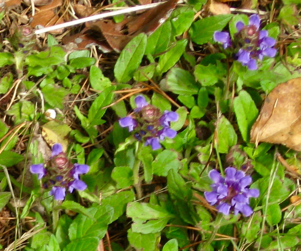
July 7, 2015. Just north of Harris Beach is the 12-mile stretch of the southern Oregon coast known as the Samuel Boardman State Scenic Corridor. Most of the scenic area is the rocky coastline between U.S. Highway 101 and the sea, mostly accessible from hiking trails. With limited hiker capacity, we did the tour by car. We stopped at nearly every beach, trail, and overlook. We had stopped at the Lone Ranch Beach picnic area in 2014; so our first stop on this trip was the Cape Ferrelo lookout, where we spent a good amount of time photographing non-native wildflowers like dandelions, oxeye daisies, and salal berry. There was also common yarrow, and a flowering plant with a purple perianth (petals and/or sepals) and a maroon cone-shaped center that I can't identify to even the broadest taxa using photographs and web sites, no matter how hard I try. I found out there are apps for identifying plants in the field, one I plan on getting for the next trip. Any botanists viewing this blog are invited to give identification of this interesting plant a try.


Common foxglove (Digitalis purpurea)

Cape Ferrelo
The highlights of our second run up the Samuel Boardman State Scenic Corridor were two particular iconic stopping points - the Whaleshead viewpoint and Arch Rock. We first took in the view of the northern half of the scenic corridor from the House Rock viewpoint (photo on top) then headed up to Whaleshead.

I tend to see patterns in the rocks on these rugged coastlines, and I can clearly see the whale shape of Whaleshead Rock. While the northern part of the rock represents the head, the southern tip has the shape of its fluke-like tail. Also looking closely, I see a small rock shaped like a sea lion looking up at the whale near what appears to be the middle of its large form. It might take some imagination, but that is one of the wonders of nature's art--every eye that beholds it may see it differently. We took a walk down to Whaleshead beach to enjoy the enormity of the rock formations from the beach perspective. Just north of the whale's head is a tall, cone-shaped rock--the combination of the two making this area stand out in this coastal landscape.
Whaleshead Rock from the viewpoint
Vegetated sea stack
Then we headed north to Arch Rock. From the highway, there is a mellow trail that mom could handle that takes you out along the green and rocky bluff to view the sea stacks and vegetated rock islands, pristine beach, and other spectacular scenery to the seaward edge where Arch Rock prominently stands. This was written up as one of Oregon's best easy hikes. And I am writing it up as one the most beautiful easy hikes I've ever been on. I'll let the photos speak more than the words, but even the photographs can't match the glory of being there.


Arch Rock appears like a monument from behind the lush young spruce forest

A pristine beach extending south from the Arch Rock bluff--I'd venture to guess where no human feet touch the sand

Churning yet calm--the ocean water interacting with Arch Rock
That was just the car tour suitable for an 83-year-old and done in one afternoon. My imagination goes wild when I think of the day I revisit this scenic corridor with more time and a hiking partner and experience this wonderland from the perspective of its great trails, including segments of the Oregon Coast Trail. We ended the day in Gold Beach, once again splurging on the wonderfully priced and located Gold Beach Inn. Just a note that the owners of this inn and the Ireland Rustic Lodges were facing bad reviews rigged by the town's competition. Don't let those reviews fool you. Every time I drive this coast I stay at that hotel. It's the best price-value point in the area and comes with beachfront hot jacuzzis that satisfied an already happy soul after dining on a nice gourmet pizza down the road at the Panther's Den.

To bring you further into the experience, I'll leave you with a little video taken from the Arch Rock trail. However, being there is the real experience that I could never quite capture with my blogging and media.


Saturday, March 18, 2017

Oregon coast random ride 2015 - Ashland to Harris Beach


Shasta-Trinity Forest
July 5-7, 2015. In 2014, our random ride had left off at Samuel Boardman State Scenic Corridor on the southern Oregon coast, and this year's trip was to continue north from there. But since then I had gotten a little mixed up. I confused Samuel Boardman with Harris Beach State Park, which is farther south, and made the advance camping reservation for two nights at Harris Beach. Harris Beach is just north of Brookings, Oregon, not far from the California border. First, I chose a rather long route. Instead of coming up through Humboldt and Del Norte counties again from California, I chose to take Interstate 5 north to where it meets U.S. Route 199 in Grants Pass, Oregon, not realizing we were going a good distance north to go south again. Then we had a bit of a mishap on that route, giving this trip a nickname of the Ashland bookends. My Dodge truck overheated on Interstate 5 in the Shasta-Trinity National Forest just south of Dunsmuir, California. The water pump went out. We waited several hours for a tow truck from Mount Shasta City, and he towed us to a recommended service station in Ashland, Oregon.
A wild hippie van where we broke down
It was late and we had to spend the night in Ashland. I lost the first night of my reservation at Harris Beach. Because we were broken down, we got a decent rate at La Quinta Inn and Suites across from the service station, which is now apparently closed. Deciding to make the best of the tiring day, we enjoyed the indoor pool and jacuzzi before retiring for the night. The next day, the mechanics seemed to take forever to exchange the water pump on the truck. Since we had to check out of La Quinta, the mechanics shuttled us downtown to pass the time at Lithia Park. In the past, we had made annual trips to the Oregon Shakespeare Festival in Ashland and had spent a lot of time exploring this park. It's a beautiful, peaceful place still holding strong the ambience of Oregon artists and hippies. But it also attracts a good amount of wealthy tourists that come to see the plays, so lunch at Louie's Bar & Grill was delicious but expensive. We were a little lazy to do much exploring and spent most of our time at the duck pond behind the outdoor Allen Elizabethan theater.


Lithia Park duck pond, Ashland, OR
The truck wasn't ready until 4:00 PM and we had to make it to Harris Beach to secure my reservation for the second night. Worse, the host wanted us there by 6:00. We wasted some time in Medford trying to get gas and a map to determine which way to go. My mother wanted to cross the Rogue-River Siskiyou National Forest on forest roads, pitching a fit that if we took Route 199 back into California, the agricultural inspectors would take away the produce she brought. That was not going to happen without us getting lost and getting to the campground too late. So I took Route 199 anyway and the agricultural inspection station was closed. However late we got to Harris Beach, maybe about 7:00, we kept our reservation. The trip didn't seem to start too good with the timing being disrupted by an expensive auto repair; however, once we set up camp, made our dinner, had our marshmallows, and curled up in our tents to the sound of the Pacific Ocean, we were feeling fine.

In the morning, my brother and I took a walk down to the beach with a docent-led group for some tide pooling, We wandered the tide pools with children and their parents, finding sea anemones, mussels, limpets, snails, and other interesting creatures. The docent had a sea worm in captivity to show us and talk about.

California mussels

Giant green anemones with ribbed limpets and black turban snails

Aggregated anemones

Anemones with algae and rockweed

Then we hiked back up to strike camp and take mom to the Harris Beach overlook, taking in that spectacular view until our tummies started rumbling for the Hungry Clam in Brookings, our favorite seafood place in the southern Oregon area.


Friday, March 17, 2017

Fireworks over Lake Oroville

Sunset over Lake Oroville

For fourth of July, 2015, I saw there was an annual fireworks display over Lake Oroville, near Oroville, California. Lake Oroville was built as a water storage reservoir from Oroville Dam, the tallest earthen dam in the United States. Lake Oroville is the second largest lake in California and holds water from the Feather River for dozens of California cities and millions of farmers, landowners, and residents. It was built by the Department of Water Resources as part of the State Water Project back in the 1960s and provides water storage, flood control, a fish hatchery, and habitat for fish and wildlife. Like most reservoirs, the lake has an extensive recreation area for people to go fishing, boating, and camping. The recreation area is located in the foothills of the Sierra Nevada, in a beautiful location with forested slopes and hills and high vantage points of the lake and surrounding area. The fireworks display was being shot from the top of the dam, but finding the right spot from which to view the show would be challenging.

After a nice dinner at Applebee's in Oroville, we headed up the Olive Highway in my truck towards the reservoir. The first challenge was finding the general location--where along this massive lake we should go to get a good view not blocked by mountain sides or trees. As we made our way towards the dam, we also discovered that the event was very popular and we were far from the only ones who had the idea of coming up there. We found the right area, but were met with huge crowds of people and traffic along the narrow residential street of Royal Oaks Road. We didn't get the memo that up to 15,000 people were expected to show up and most were being shuttled in. We found the golf and event center where people were gathering, and had to drop the elderly parents off, then set off to find parking. So my brother and I went back out to Kelly Ridge Road and found a parking lot at the Lake Oroville Visitor Center to walk from. So far so good.

Back at the golf and event center, the place was filling up with people drinking a lot of beer and bad karaoke singing heard in the distance. The fireworks took awhile to start and was accompanied by loud, dramatic music and even a louder crowd. It was a nice display, and we could see the fireworks in the sky; but from our vantage point, not reflected over the water as I had originally hoped. The water level was low due to the 2015 drought, and people blocked view of everything but the sky. And people were practically tripping over us. It was a bit disappointing, but the misadventure didn't stop there. After the show, my brother and I negotiated the now somewhat rowdy crowd to walk back up to the truck and drive it down to pick up my husband and parents. When we got to the intersection, Royal Oaks was blocked by police. We could not get to the parents--they would not let us in. Some drunk caused an accident, I believe, and my folks were stranded with the stragglers and getting nervous before the cops finally let us inside to get them. That was a tiring ordeal, but getting back down the mountain into Oroville was another story. Backed up, bumper-to-bumper traffic on the steep grade was no picnic for my truck's manual transmission. I nearly burned out my clutch trying to get down that hill without plowing into the cars in front of me.

Well, not every 4th of July attraction is what I thought it would be, but the organizers were pleased. We didn't even attempt to make it to the parking lot party. Perhaps we would have had better luck if we came earlier in the day. However, it was an experience and a memory--and that's what getting out and doing these things is about. Sometimes it's a winning experience and sometimes not so much. In any case, there are other ways to explore the Lake Oroville Recreation Area.

Saturday, November 19, 2016

North Delta's Prospect Island


East side of Prospect Island, Solano County, California

Still stoked on the topic of habitat restoration in the Sacramento-San Joaquin Delta, I went on a field visit to Prospect Island in Solano County, California, on June 17, 2015. A few of us state employees were privileged to go out with people who will conduct the restoration work once the plans are finalized. Prospect Island is about 20 miles southwest of West Sacramento, along Highway 84, which originates from Jefferson Blvd. The island, mostly owned by the Department of Water Resources, sits between the Sacramento Deep Water Ship Channel and Miner Slough. Highway 84 follows the eastern side of the island on the Miner Slough side until it makes its way south to the Sacramento River and the city of Rio Vista.

Miner Slough from the east levee road

On this bright, sunny day in June, we entered the island from the croplands to the north near the small boathouse community of Five Points on Miner Slough. As we made our way down the east levee road, we took a pause at the northeast location where a planned breach in the levee will be made so that tidal flow from Miner Slough will enter the island and create subtidal and tidal marsh habitat for native and endangered fish such as Delta smelt and Chinook salmon. The project is part of the Fish Restoration Program, designed to mitigate for effects of the state water project and Central Valley project on endangered fish. We continued south and stopped again at a beautiful spot with a view of the vegetated cross levee that separates the north property and the south property (top photo). We kibbutzed about permitting and such, particularly since there is good giant garter snake wetland habitat that could be turned into fish habitat--a tricky little dance between endangered species unless and until the project restores marshlands for the snake as well.
Wetlands that could support giant garter snake

At this stop, we were probably near a nest of the state-threatened Swanson's hawk, because the bird made a racket letting us known we should be on our way. Then there are people who own property here and call this island home. We passed by the very odd entry to "the Stringer property" along the slough, with a gated sign that said "Eden", a little island in itself meant to be a sanctuary from God and access to recreation for its owners.


Then we continued to the south side of the island from where we could catch a view of the deep water ship channel on the western side, then left the island to head east across Road 220 to move on to our next adventure.

Walking through a riparian grove on Prospect Island.
Photo by Brandon Amrhrein 
A year later, on June 1, 2016, I was on a boat trip through that section of the Delta and enjoyed a second visit to Prospect Island. The restoration project is still in the permitting stage and is planned for a start in 2018. We boated up Cache Slough and swung by the Miner Slough Wildlife Area, which is on the southern tip of Prospect Island. We then headed up the Sacramento Deep Water Ship Channel along the western side of the island. We docked our boats at the vegetated levee that separates the north and south properties, on the opposite side of where I had been driven to the year before. We started walking across the levee towards the eastern side of Prospect Island, stopping to view and enjoy the freshwater wetlands on both sides of the levee. The wetlands hosted a nice sized group of white pelicans, and other wetland birds, and it was hard to imagine the levee we were standing on would soon be breached. 
White pelicans on Prospect Island.
Photo by Brandon Amrhrein 

After fine photo ops and discussions, we headed back down the ship channel to continue our journey up Prospect Slough--the boat trip to be continued in a future blog.

It is an interesting preponderance when one natural community is converted into another to benefit particular species. One scene of beauty might segue into a different one; and as these restoration projects come online, the Delta is slowly being nudged towards the way it used to be before it was reclaimed for farmlands. But it will never fully return to its historic state, because it is now a place of deep human history and culture as well as natural wetlands that needs to also be preserved. It's a delicate dance indeed. 

Wednesday, November 11, 2015

Tricolored Blackbirds of the Port of West Sacramento

The search for tricolored blackbirds (Agelaius tricolor) at the Port of West Sacramento along the Sacramento deep ship water channel started last year. A field biologist and I hiked out to the ship channel's levee access road via Carlin Drive in West Sacramento, hoping to detect a breeding colony across the channel in the Yolo Bypass Wildlife Area. We walked the levee road a bit to the south, and as we were about to give up, we saw a foraging flock of about 40 tricoloreds in the non-native grassland on our side of the channel. It was late April during the volunteer-based statewide survey organized by the Audubon Society and UC Davis. We tried a few other spots along the channel, as well as within the Yolo Bypass Wildlife Area, but had no further luck.

Tricolored blackbird is a species of special concern that may very soon become listed as endangered, pending on a decision by the California Fish and Game Commission. Nearly endemic to the State of California, the species has faced precipitous decline over the past several decades, declining 44% between 2011 and 2014. When a friend and colleague of mine suggested we go out this year and look for them, I was eager to go back and cover some of the spots at the Port of Sacramento that my former field partner a year ago was not willing to try to access. So exactly one year and one day later, my friend and I hiked out to the same levee access road from a dirt road off Ramos Drive.

This time we went north up the levee access road instead of south, along the ship channel towards the Port of Sacramento and Washington Lake. The road is owned by the Port of Sacramento; however, not just wildlife biologists looking for blackbirds use it. We saw others running, biking, driving, and fishing along it as well, so it is one of West Sacramento's hidden recreation spots for only those who know about it. We walked about 3 miles and didn't see the blackbirds, but enjoyed the exercise and some good conversation. Then we turned off the levee road and started heading back towards the street where we had parked, in the late part of the afternoon. Pausing for a quick pit stop, I spotted the foraging flock.

About a week later, I dragged my brother and husband out to the same spot along the ship channel so I could confirm the sighting and get GPS coordinates. It was earlier in the day, and this time I took some photographs of the deep ship water channel and the habitat. I did not get a shot of the blackbirds, however, as I had three years ago in the Livermore area.


Non-native, annual grass field where the tricolored blackbirds were seen foraging

We walked along the channel and again could not find the birds. Until once again, when we turned to leave and paused for another pit stop, I saw and confirmed the identity of the tricolored blackbirds. One way to distinguish foraging tricoloreds from their almost identical looking cousins, the red-winged blackbirds (A. phoeniceus), is their flocking behavior. The tricolored flock will suddenly emerge from where they are hidden in the grass, fly back and forth in a synchronous motion, and land again in another spot in the tall grass, where they disappear from sight until they emerge again. If I was quick enough to get a scope on them or close enough to get them in my binoculars, I might have been able to see the characteristic white patch on their wings that also distinguishes them from the other blackbirds. But I didn't.

Each time I saw this flock, I saw them fly off in the direction of the ship channel. It made my colleague and I wonder if there actually is a breeding colony on the other side, and if we could somehow get access to that levee and peer over the toe drain part of Prospect Slough that separates the ship channel from the wildlife area. There was also some really lovely looking freshwater marsh habitat in this area that was beckoning us to visit. We didn't get around to it this year. I am hoping next year to not only seek a new adventure along the ship channel, but to locate a breeding colony of tricolored blackbirds in an area where they seem to be rapidly disappearing from.


Friday, November 6, 2015

Flight Over the Delta Part 2

Lindsey Slough

In part one of "Flight over the Delta", an early dense fog and President Obama's flight path to the Cyber Security Summit in Palo Alto blocked many of the views we were hoping to see from our small 4-seat fixed-wing aircraft. So my colleagues and I were very fortunate to be invited again to take to the skies for live aerial views of the landscape that our daily working lives are dedicated to. This time it was a bright and sunny day in mid April. No fog, no Obama, no Dramamine, and a map to help me figure out where we were. I could pay closer attention to the locations of the natural communities I hope will be protected and restored in California's Sacramento-San Joaquin Delta. We met at the hangar and took a different plane on this day, one with larger bubble windows. I couldn't have asked for a better day.

The photos and video I took with my iPhone will tell the rest of the story. Well, almost the rest.

Sacramento River from Hood to Courtland, CA. 
This is where the twin tunnels intake pumps would be constructed if that project goes through.

Brannan Island State Recreation Area on the Sacramento River.
This island has one of the last remaining dune habitats in the Delta.

Tip of Discovery Bay, Contra Costa County

Tyler Island and North Mokelumne River. Look closely to see Sacramento River, top.
Vernal pool-grassland complex in the Mountain House mitigation bank for species like California red-legged frog and California tiger salamander.

Some lovely riparian habitat along the San Joaquin and Stanislaus rivers, but a lot more needs to be restored here to bring back the species that once occupied this area but are now gone:


We diverted a bit from the Delta to the east to see how the reservoirs of the Sierra Nevada foothills  were doing during the drought. We probably shouldn't have been surprised by what we saw. The low water levels and exposed land are due to a record-low snow melt in the mountains. It's a little frightening when thinking about how much water is consumed in California.
New Melones Lake. Water level changed so much in a matter of weeks, I could not match this image to Google Earth.

Narrow band of Sierra Nevada snowmelt


Leaving New Melones


Camanche Reservoir with exposed islands
After our detour to the foothills, we returned to the Delta so we could get good bird's-eye views of Suisun Marsh. Suisun Marsh isn't technically within the legal Delta boundary; however, it is that part of the San Francisco Bay estuary that links the Delta with the San Pablo and San Francisco bays. It consists primarily of managed wetlands for waterfowl habitat and duck clubs, but plans have been underway to restore these diked wetlands to the historic state of a natural tidal marsh ecosystem. I had visited Suisun Marsh many times on the ground; but had never imagined how colorful it would be from the air.
Grizzly Island Wildlife Area and Roaring River Slough

Flooded island between Wheeler Island and Van Sickle Island

Montezuma Slough and the Montezuma Hills
We circled around Suisun Bay and Grizzly Bay, then headed up to Lindsey Slough and the north Delta. I took one last shot of Cache Slough and Lindsey Slough meeting up with the now-flooded Liberty Island (top of photo below):


Now the rest of the story: After reveling for a couple of hours in the air, our aircraft landed and we were told to hop out. But for some strange reason, it was super easy to jump out because there was such a wide open space. In other words, there was no door. It wasn't until we were out, standing on the tarmac, that our pilot said, "Where's the door?" Apparently, it fell off and landed somewhere in Suisun Marsh. We were all so enthralled in our habitat viewing, photographing, and video recording, none of us noticed--not even my colleague who was sitting next to it. It wasn't until we were off the plane that we realized the door was no longer there. We all got a good chuckle out of it. We were well strapped in, and the flight was low and slow, so there was no noticeable change in air temperature, pressure, or anything dangerous or scary. We were just having a little adventure that we weren't even aware of.  And now that we were back on terra firma, it was time to go back to work in the office and look forward to another adventure.