Sunday, December 29, 2013

Bordering the Desolation Wilderness


The Lake Tahoe region of the Sierra Nevada range has a lot more to offer than Lake Tahoe itself. To the west and the south of the lake on the California side are three wilderness areas surrounded by the El Dorado National Forest, the most popular being the spectacular Desolation Wilderness. This 99-square-mile area of outdoor adventure has over a hundred small lakes amidst striking peaks and mountain passes of white volcanic granite, alpine and sub-alpine forests, and glacially-formed meadows and valleys. It extends from the southeast near the Echo Lake complex (easily accessible from U.S. 50) to Loon Lake on the northwest, which is accessible from Ice House Road. Technically, these bordering lakes are in the National Forest just outside the wilderness boundary, and the beauty they offer are nothing to sneeze at either. And these lakes provide car camping, boating, hiking, fishing, and other recreational activities.

Echo Lake (2008)

Wrights Lake (2009)


I haven’t quite yet graduated to the deep wilderness backpacking excursions that would be required to hike into the Desolation Wilderness interior, but I have enjoyed visiting its edges, peering at its enticing viewshed, and hiking, birding, picnicking, and even spinning in circles on a raft in the middle of Wrights Lake. In August of 2013, we decided to visit Loon Lake. We chose to take the Wentworth Springs Road out of Georgetown, stopping for a few snapshots at Stumpy Meadows Lake (well, we had to stop there, mom’s nickname is Stump). We accessed Loon Lake from its south shore and started looking for a good spot to have lunch. The north shore Loon Lake campground provided that spot, so we paid a small day fee and grabbed a site. After our nice picnic lunch and me getting stung by a yellow jacket, we took the very short hike down to the lake. A large pile of granite rocks provided sweet couches to kick back upon on the lake’s northern shore and look across towards the Desolation Wilderness. The sun was out and I was so relaxed, I think I caught a snooze.

Loon Lake

Stumpy Meadows Reservoir


For those that are not faint-hearted about very steep, narrow, windy roads that drop very quickly in elevation, Ice House Road is the best way to drop south to U.S. 50. The views are gorgeous, particularly as the road passes right by the Union Valley and Ice House Reservoirs, and a good driver gets you to the highway safe and sound.

Saturday, December 28, 2013

Trinities and Pacific Coast Redwoods


In 2012 our 4th of July Random Ride ended in Red Bluff, in the northern Sacramento Valley of California, heading west on Highway 36, facing the Trinity Alps and Pacific coast. So on July 4, 2013 that is where we picked it back up. We launched from Red Bluff’s Comfort Inn and took Highway 36 west into the Trinities, looking for a place to camp. We found a small, steep hill to hike with a view, and then about 2 PM found the perfect spot. We spent a lovely afternoon and evening at the Forest Glenn campground, nestled along the south fork of the Trinity River in the Shasta-Trinity National Forest. Besides making the meals, pitching the tents, and sitting around the fire, we made several small trips down to the river; on one such trip I was greeted by a swimming garter snake.
I shared a tent with mom, our blow-up bed sunk to the ground, and we stayed up most of the night talking and laughing.

Trinity Alps

Forest Glenn

The next morning we continued west. Getting ice and lunch was a challenge in the mountains on a holiday weekend; and the Hydesville grocery finally delivered on ice and coffees. Then our journey took us to Fortuna, off Highway 101, and we found a delicious lunch spot at the Hunan Village on Main Street. From Fortuna, we wound up on the southern, windy, and most rural end of Tompkins Hill Road. Passing the farmlands and the college, our next destination landed, happily for me, at the Humboldt Bay National Wildlife Refuge. Random riding is a travel game I invented with a set of rules, and no conscious decision-making (other than how to interpret the rules) shapes the trip. It takes us where it takes us, and on this one, we just kept getting lucky. Birding the Humboldt Bay estuary was more than I could have asked for. And what a sunny day for Humboldt County. 


Our next challenge, however, was finding a place to stay on a Friday night, 4th of July weekend, on the California coast, without any reservations. We almost wondered if we would wind up in our truck, but we were fortunate. The campground host at the Elk Country RV Resort and Campground just south of Orick didn’t realize they were full. She sold us a campsite that didn’t exist, so we pulled up a nice spot of grass between sites, pitched our tents, and slept very coldly, listening to the sea lion choruses from across the highway. Upon striking camp the next day, we didn't see elk, but we were treated to the hospitality of an Elk Country Resort 4th of July barbeque. For a modest donation, we feasted on ribs, chicken, beans, and coleslaw while listening to a loudly broadcasted classic rock America mix. Now that is patriotic. 

Heading north on 101, we stopped at the beach at the Thomas H. Kuchel Visitor Center, our gateway to the Redwood National and State Parks. We took the Newton B. Drury Scenic Parkway through Prairie Creek Redwoods State Park. Our first stop was the visitor center, and we started hiking up the Prairie Creek trail. We were in sudden slow-mo as we lost ourselves in our amazement of being engulfed within the huge, majestic redwoods. I have camped, hiked, and even lived in the redwoods ever since childhood; but every time I go it’s like the first time. These woods are that awe-inspiring. Sequoia sempervirens, the coast redwood, is the world’s tallest tree (up to 377 feet high), can live up to thousands of years, and creates an incredibly diverse ecosystem for hundreds if not thousands of other species. Yet it exists only in coastal northwestern California and southwestern Oregon. The World Conservation Union lists it as Vulnerable, facing a high risk of extinction in the wild in the medium-term future. Its fate rests precariously within cooperation between the public, the timber and other industry, private landowners, conservation groups, and government resource agencies. Our afternoon ended with a visit to the Big Tree Wayside. The Big Tree is a mere 304 feet high, with a 68-foot circumference, estimated to be 1500 years old. Some joker in the past wanted to cut it down and turn it into a dance floor, but a public outcry saved it.
Prairie Creek Redwoods State Park

The Big Tree Wayside
We decided to try to start a little earlier to find a place to stay. We continued north to the town of Klamath and found lovely tent camping along the Klamath River at Cat’s RV Park. We were given a complimentary stay because of some out-of-hand camper, and I was awoken to quite the symphony of riparian birds singing above my tent. A visit to the river dock terminated the trip. 


Orick’s only coffee shop, the Palm Café, served us lunch on our way back south, and then we headed east into the busy Central Valley.

To be continued from Prairie Creek State Park in July 2014.

Thursday, October 31, 2013

Lunch at Lake Tahoe


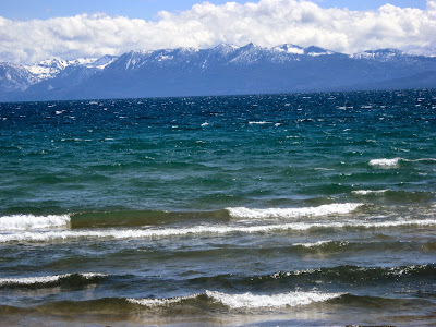
Lake Tahoe is one of California’s and Nevada’s wonders of the world. Anyone visiting the western U.S. should try to take the time to visit this deep blue-green scenic treasure of a lake, 50 miles in circumference, nestled in the granite rock evergreen forests of the Lake Tahoe Basin. It is deeper than any other lake, and offers more natural beauty, geologic and historic mystery, and exciting nightlife opportunities than just about any other spot in the world. People come from around the world to marvel in its presence. I am one of the lucky ones that can run up the hill for lunch in Lake Tahoe in just one day. King’s Beach, on Tahoe’s north shore, is my spot of choice for that excursion. South Lake Tahoe is the developed hustle-bustle casino-resort area, the West Shore is mostly private but a breathtaking drive, while the East Shore is fairly remote and mostly for the outdoorsy types. The North Shore, however, has that combination of accessibility on its public beaches that is off the beaten path—meaning not too terribly crowded--and cute small towns, great scenery, and good little eateries. On one nice day in King's Beach, we grabbed sandwiches from Annie's Deli and had a picnic on the beach; on another day, nice gourmet coffee drinks at the Java Hut. But for the special occasion such as our engagement and anniversary, our North Shore choice has been Jake's on the Lake.
Geese enjoying a rainy day at Sugar Pine Point State Park

The weather, however, is unpredictable. On a hike at Sugar Pine Point State Park in June we got rain; during our evening dinner in August, we were caught in a thunderstorm; and on an afternoon picnic in May, we got the high wind. Same months, different year: intense sun. But the beauty of our surroundings prevailed over the slight inconvenience of weather extremes that shift not only day by day, but hour by hour. That is one of the delightful surprises of the Sierra Nevada. 


Thunderstorm in August at Jake's by the Lake

Windy day in May at King's Beach

Calm day in June on the east shore


Every year in June, however, I have a deeper purpose for lunch at Lake Tahoe. Each year on this day bicyclists from around the nation and even the world convene for America's "Most Beautiful Bike Ride”. Many riders are there raising money for the Leukemia and Lymphoma Society's Team in Training. Every time I go to cheer the riders on near the top of the steepest hills by Spooner Lake, and encourage them to keep going and that they are almost to the top and the finish line, I am reminded that as a survivor of lymphoma, I struggled in a similar race for my life. I am alive partly because of the advancement of medical technology, which partly is a result of efforts like this. The cyclists thank me for the cheerleading; I thank them for helping to save my and others’ lives.
Go Team!

Monday, May 27, 2013

Whales and Dolphins of Monterey

My 80-year old mother's life long dream was to see a dolphin in the wild. I had seen them before, off the coasts of Zanzibar, Eureka, and in the Philippine Islands, but when my husband was browsing TravelZoo and found a discount for Randy's Whale Watching in Monterey, how could I say no. We took a Monday off work, and invited my parents to double-date with us for a weekend of ocean thrills and decadent seafood dining.

On Sunday February 10, we settled into the Days Inn, Fisherman's Wharf, on Munras Avenue, across from Don Dahvee State Historic Park. Since Mom can't walk too far, we decided to go down to the wharf for some reconnaissance on where we would drop her off, park the car, and locate the dock we'd depart from. Whenever you walk down Old Fisherman's Wharf in Monterey at dinner time, you are haralded by seafood restaurant owners offering free samples of hot, homemade clam chowder and enticing you with free appetizers. We chose the Old Fisherman's Grotto for a feast of chowder, oysters on the half shell, fresh crab, and calamari. I enjoyed a peppermint patty (cocoa and Schnapps) at the Grotto and relaxed in our room with its nice gas fireplace.

We were out of the hotel and on the dock by 9 AM. While waiting for our boat to depart, we hung out with the large pile of sea lions that make Monterey Bay their home and haul out on the floating dock.
We were decked out in rain pants, coats, and slicks, expecting to get wet by sea and rain, but it was a beautifully warm and clear day. As our vessel pulled us out of the bay towards the open sea, I spotted grebes, loons, gulls, cormorants, murres, scoters, and a sooty shearwater. A large brown pelican flew right by us, sea otters frolicked nearby, harbor seals and sea lions dove and surfaced as they fished. Then we saw what we had come to see: the whales. We didn't get close to the gray whales, but we did see them breaching and spouting, and we were extremely fortunate to get a closer look at the Minke whale. The real highlight of my day was coming upon the large dolphin pod, which came amazingly close to our boat, and watching them jump out of the water in synchronized breaches. They knew why were were out there and were only too kind to pay us a visit and graciously lead us to the next whale.

Pirate ship on the Bay
Our exciting adventure with the marine life ended right around lunch time, conveniently timed for another seafood splurge before heading home. We enjoyed more oysters and calamari at Rappa's Harbor View. Then it was time for us weary sailors to leave the beautiful central California coast to travel inland and return to our daily lives. 
Sailor Tim and Joe Rappa


Friday, May 17, 2013

Sutter Buttes: The World's Smallest Spiritual Historic Range

In the Sacramento Valley of California, just northwestwest of Yuba City, a small isolated range of conically shaped mountains jets up from the valley floor. At one time it was thought to be an extension of the Cascades to the north, but no--it is connected to no other range.  Some say it doesn't qualify as a range; others tout it as the "smallest mountain range in the world." Regardless, the Sutter Buttes is a phenomenon of about 10 lava-formed peaks covered with rocks and crags, grassy rangeland, and oak woodland. Much of it is privately owned, with generations of families grazing sheep and cattle, keeping development at bay, and maintaining stewardship of its timeless natural beauty. The Middle Mountain Foundation, a non-profit organization dedicated to preserving the Sutter Buttes, owns part of the land and negotiates easements with the private owners. California State Parks also owns a piece of the northern Buttes, but access to the Buttes by the public is limited. Thousands of years ago, the ancient Maidu tribe revered the "Middle Mountain" as a mecca of spirituality. Much of that spirituality and the extremely rich cultural history still remains unscathed.


For a modest fee, the Middle Mountain Foundation leads guided hikes for the public to learn about and experience the Sutter Buttes, because special permission is required to access the range through its moat of private lands. The landowners also maintain relationships with researchers--biologists who study the incredible diversity of plant and animal life that have for centuries made the Sutter Buttes home. One such researcher from Sacramento City College, who for years has passionately studied bats, ringtails, and other wildlife with his students, led a guided hike for a group of Wildlife Society members, a group I was very fortunate to be a part of. The tallest peak in the Buttes is just over 2,000 feet, and we set out early one morning in February from the cattle pond to climb about 1,000 of those steep feet. What we saw and learned from our guide was absolutely amazing.

Our first stop was a look at the small bat houses erected high on thin poles used by a wide variety of bat species that occupy the range. I worried no more about not being able to keep up with the hikers as we stopped every 10 or so minutes to hear fascinating stories about the bat and ringtail research; to learn about the variety of oaks and other flora; to see hawks, falcons, eagles, and songbirds; to find and study the sign and scat of ringtail, skunk, and other carnivores; and to witness the evidence of a very clever spider who spun sacks to haul loads of dirt out of its little hole in the ground. We even got a glimpse of feral swine and introduced baron sheep, including the white Judas sheep that always stands out and gives away the location of the herd.

The history we saw was also incredibly fascinating. We saw and walked along historic rock walls that once partitioned the pastures, thought to be constructed by Chinese laborers for the early settlers; though there are some that believe the relic walls are an ancient mystery from years before even the first native settlers. Then we passed a series of bedrock milling stones used by the Maidu maybe 10,000 years ago. After much heavy breathing, I caught up with the group at the top of the peak, to have our lunch overlooking the valley. The descent down the other side took us to one of the earliest built barns still held together by those huge square nails of the past, where we were greeted by a few barn cats patrolling the area for rodents and birds. Our guide then treated us to some chocolate cake, then led us back out of the Buttes to the hustle and bustle of the much less spiritual valley floor.

The Maidu's "Spiritual Mountain"